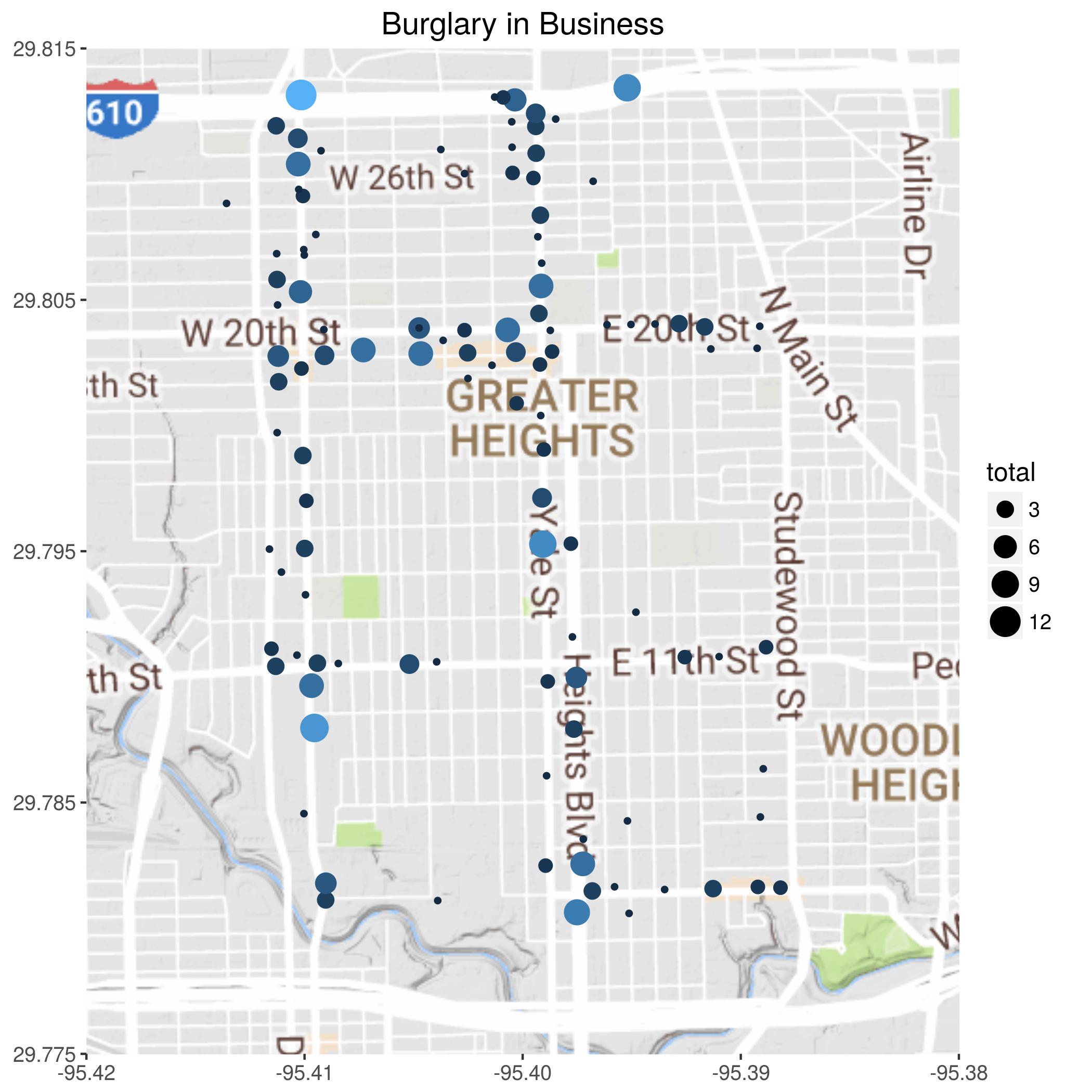
Theft at businesses
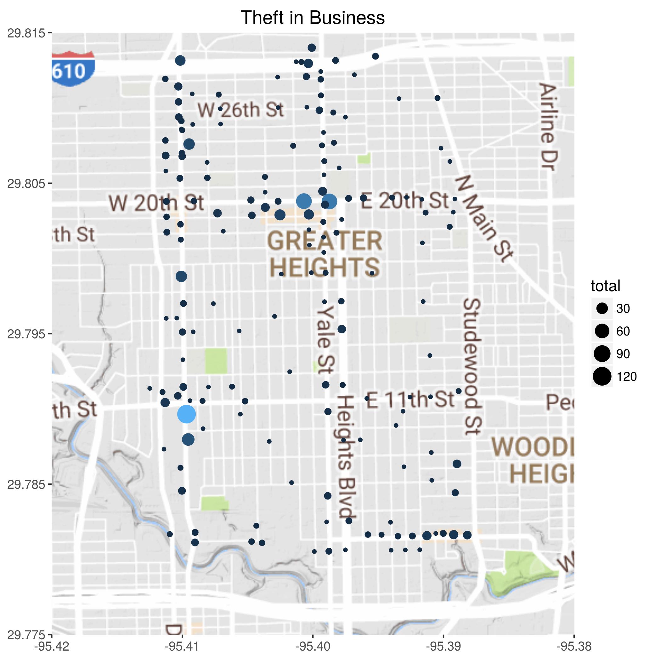
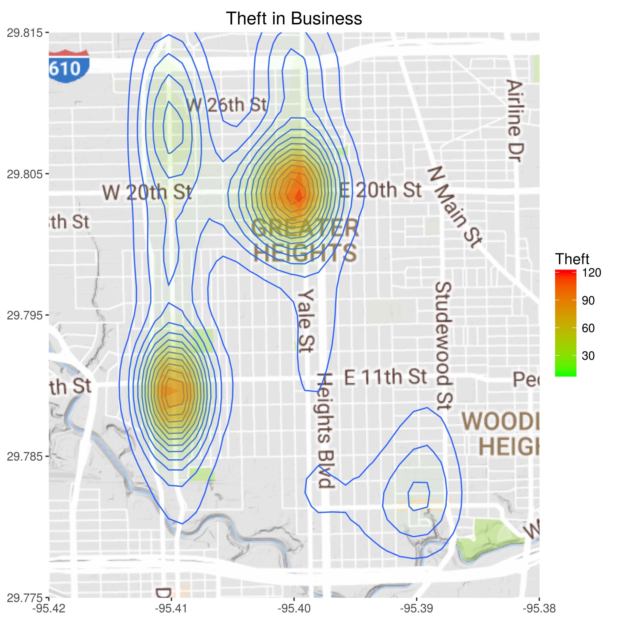
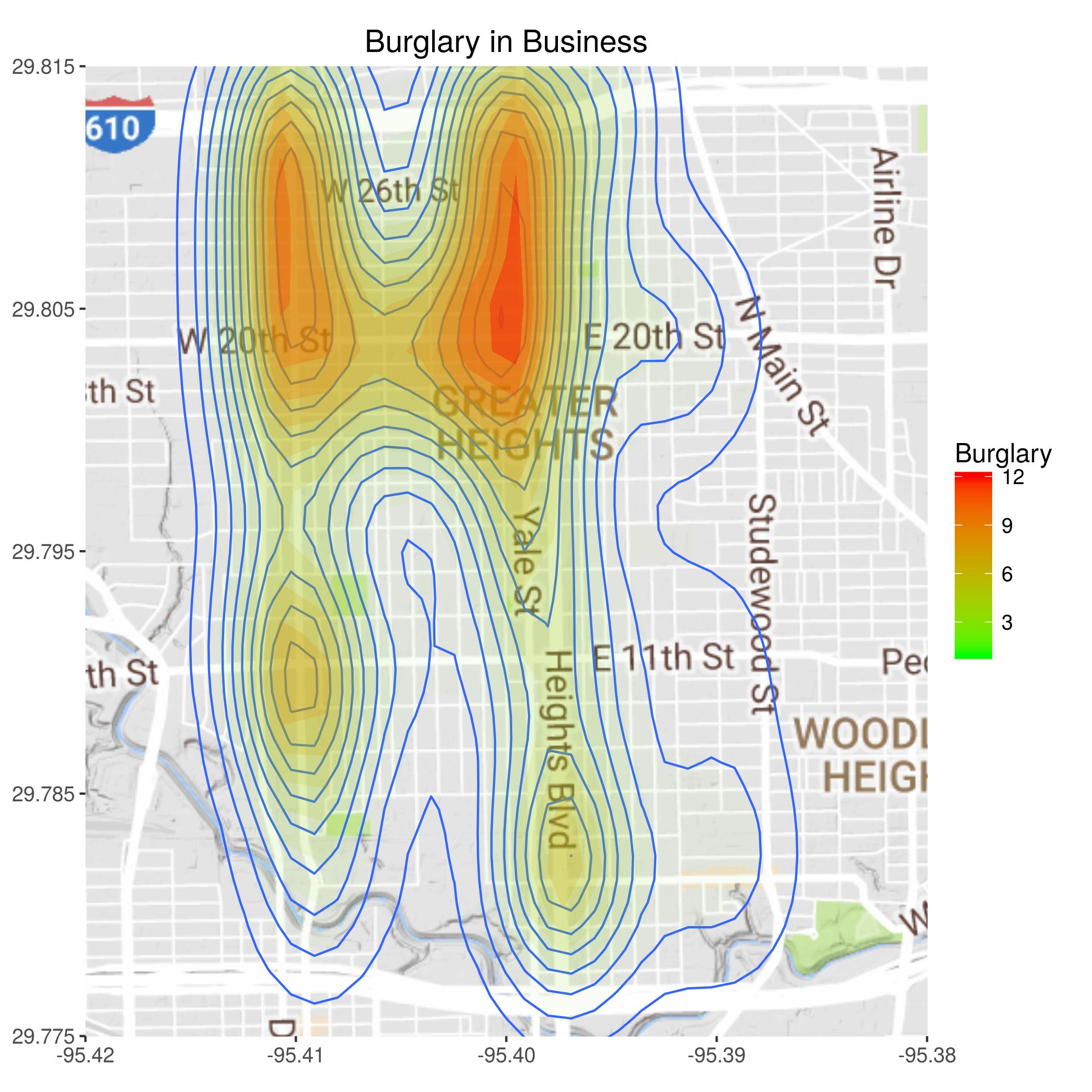
It is clear that there are two hotspots for thefts in businesses. Not surprisingly they more or less correspond to where the majority of the businesses are.
A collection of maps to help see the spatial distribution of crime.
For these maps, I trimmed back the data from Beat 2a30 to encompass only the Heights - basically from
I-10 to the south, I-610 to the north, Durham to the west, and Studewood to the east. I have generated both bubble maps
showing the actual locations and number of incidents, as well as contour maps which are better for discerning trends.
The raw data was by block, so for posting the data I have calculated the center location of each block.
Additionally
there is an interactive mapping application available.
Source code for the geocoding and map creation is also included.
It is clear that there are two hotspots for thefts in businesses. Not surprisingly they more or less correspond to where the majority of the businesses are.
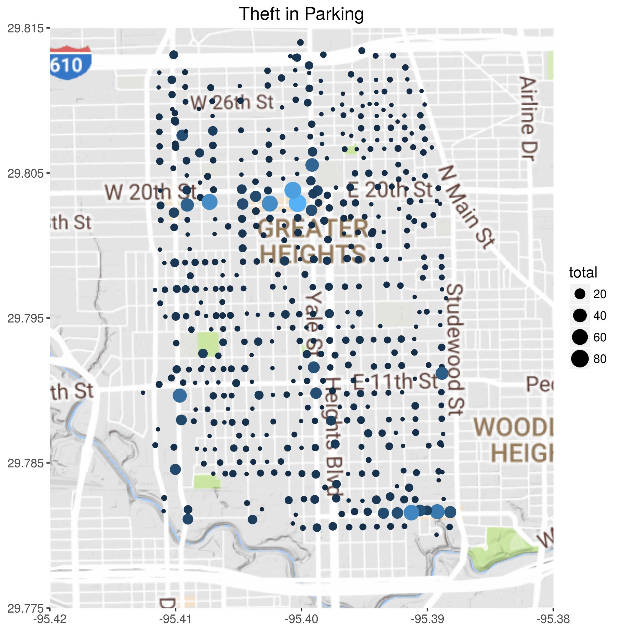
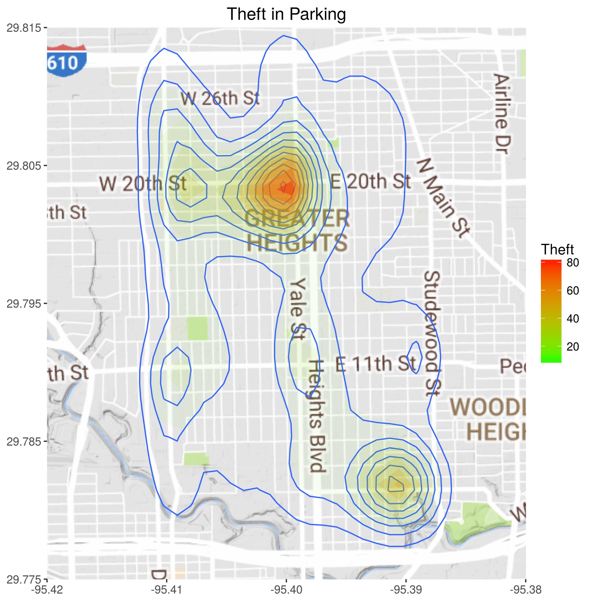
This is primarily theft from automobiles. Again, a big hotspot around Yale and 19th.
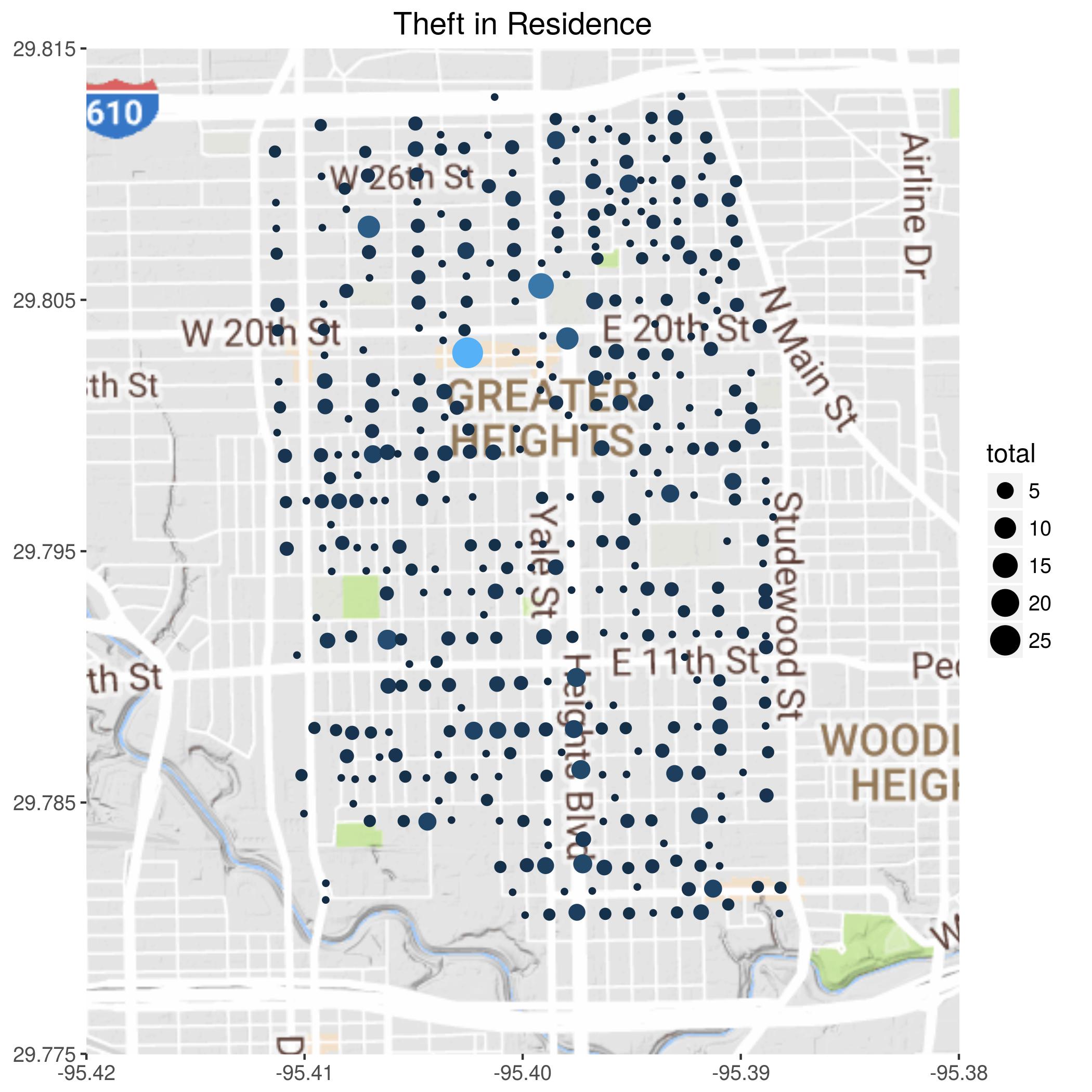
Note that this is not breaking and entering - that would be burglary. Presumably this is stealing things off a porch, or out of the yard, or an open garage.
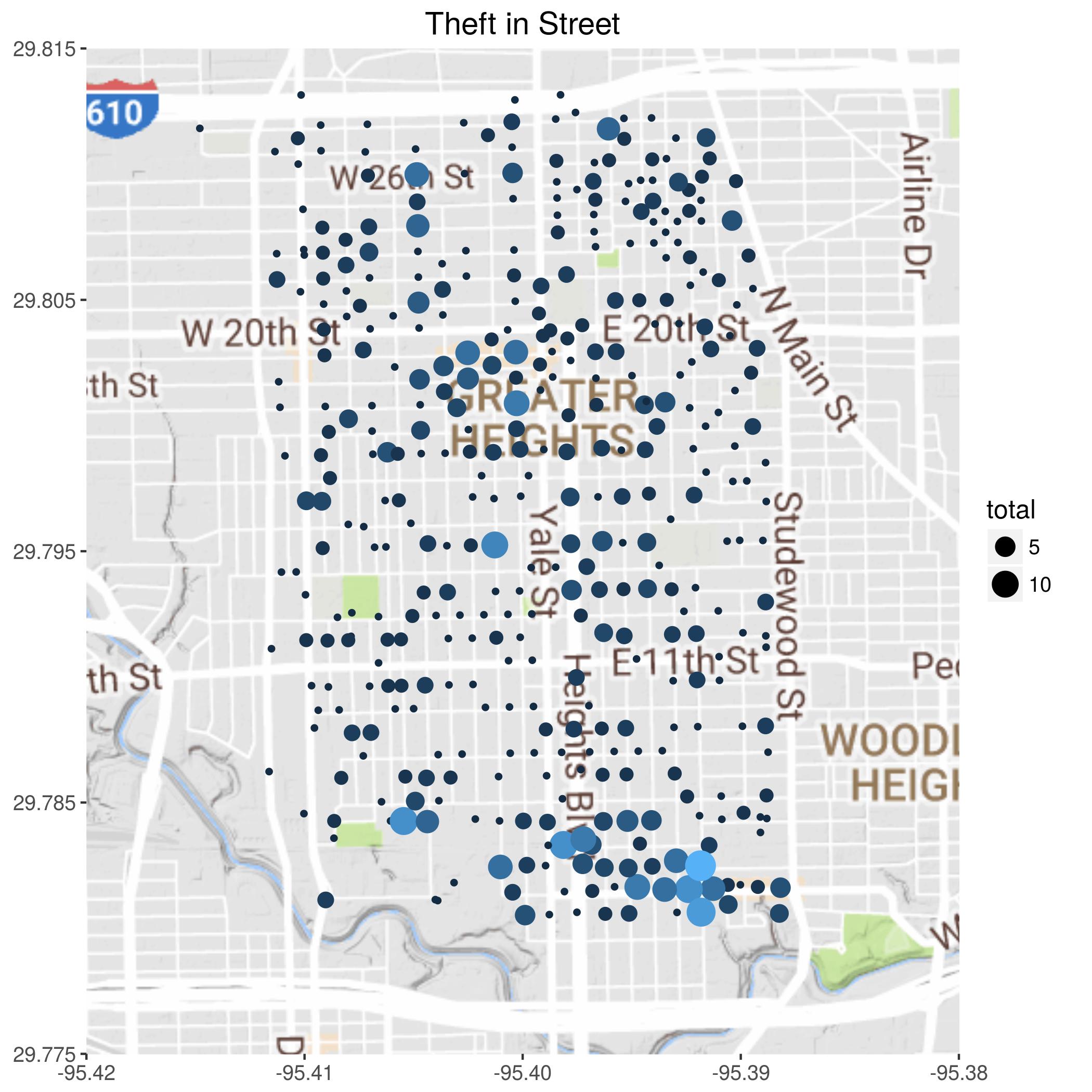
I'm guessing that this has to be stealing stuff from cars parked on the street.
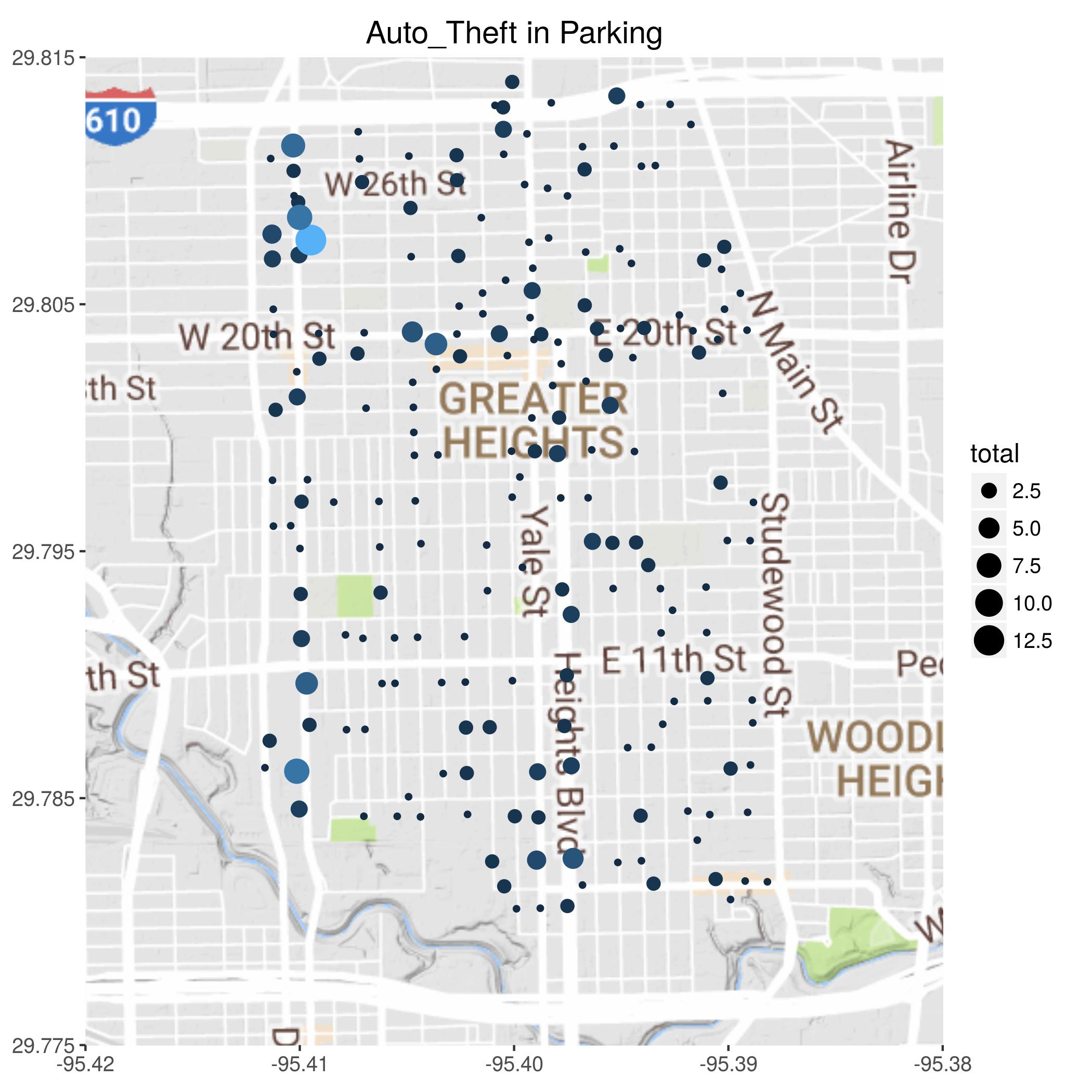
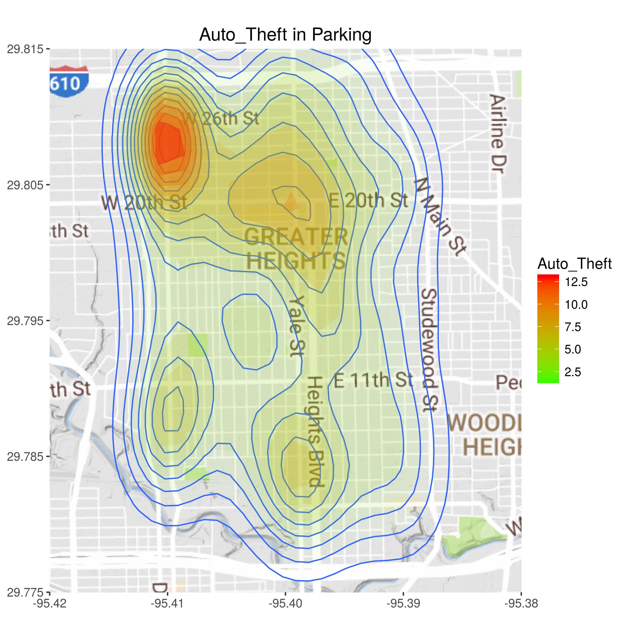
It appears that around the old Fiesta was a hotspot for auto theft. Although maybe it had more to do with all the used car dealerships?
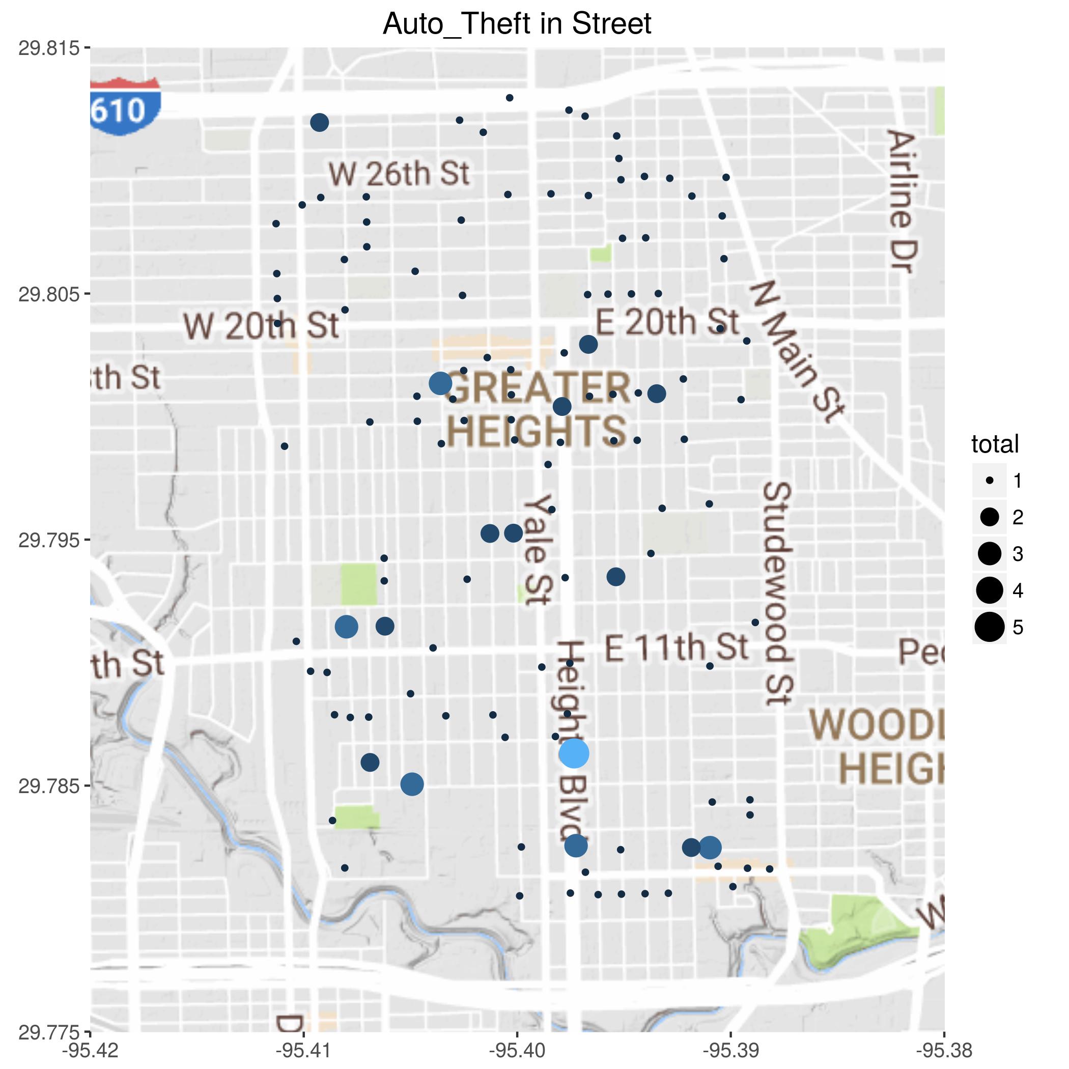
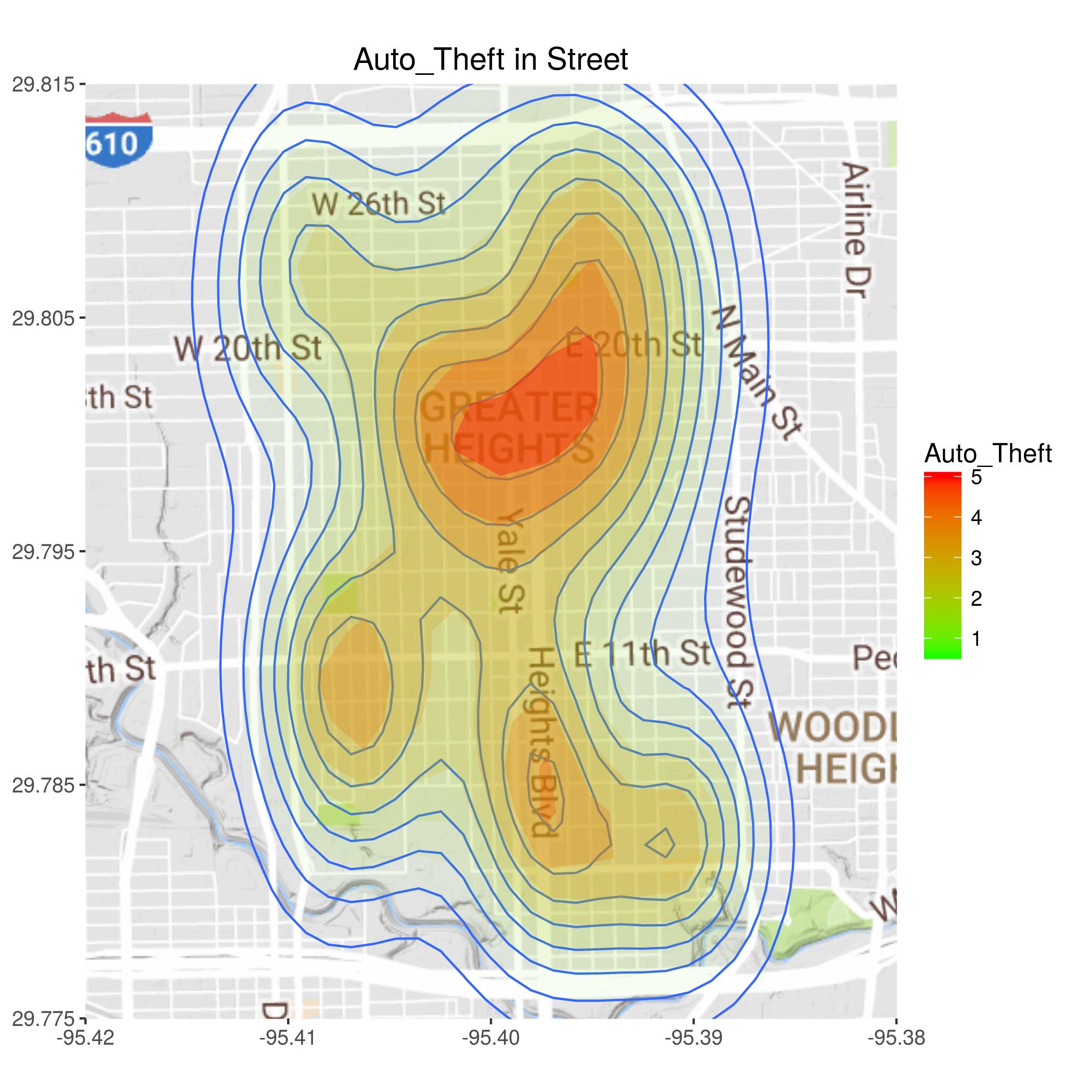
Not sure if there are any meaningful patterns here. The numbers are rather low, so it may be a more or less random scatter.
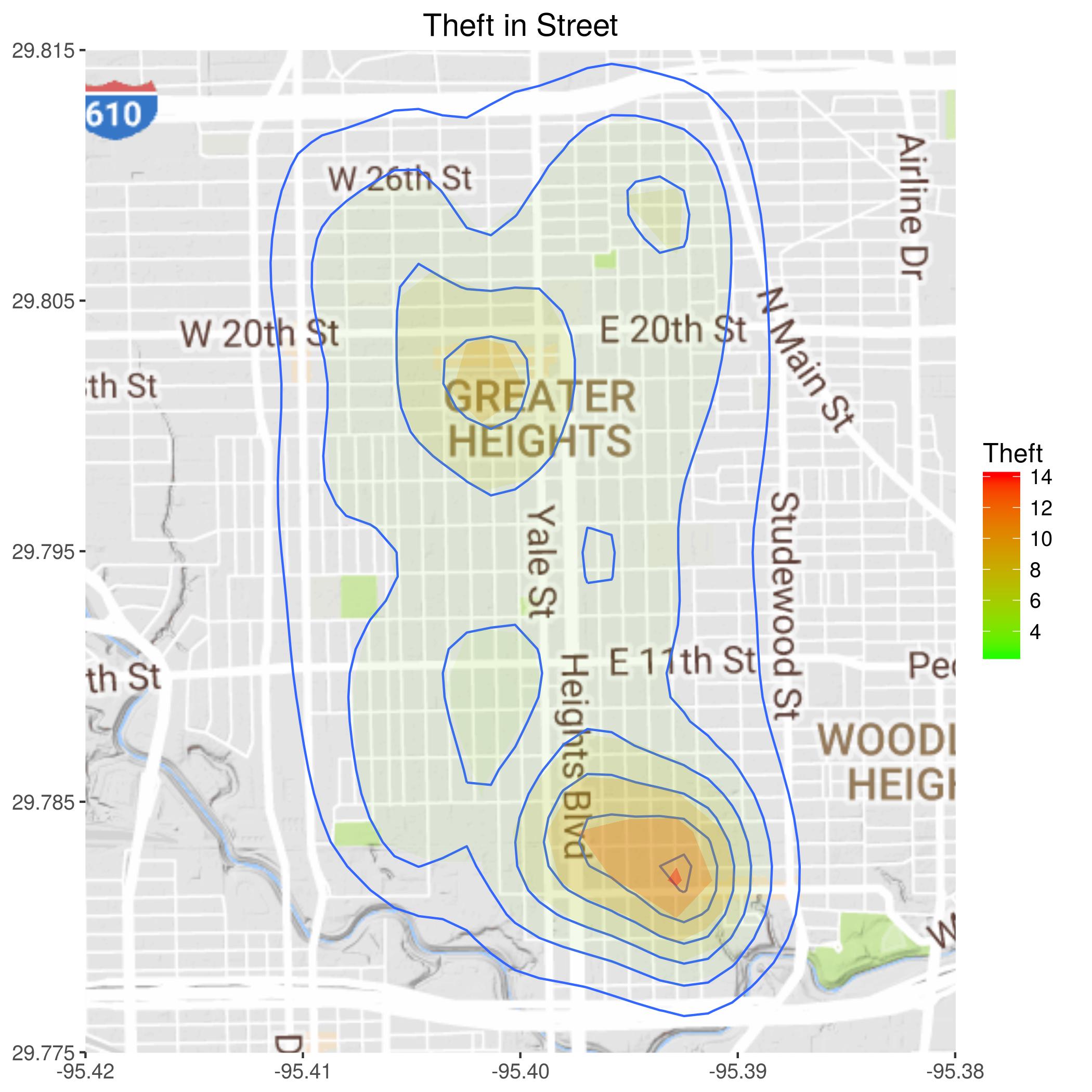
It is interesting to contrast this map with thefts from businesses. This map seems to be much more concentrated along good escape routes - major thoroughfares.
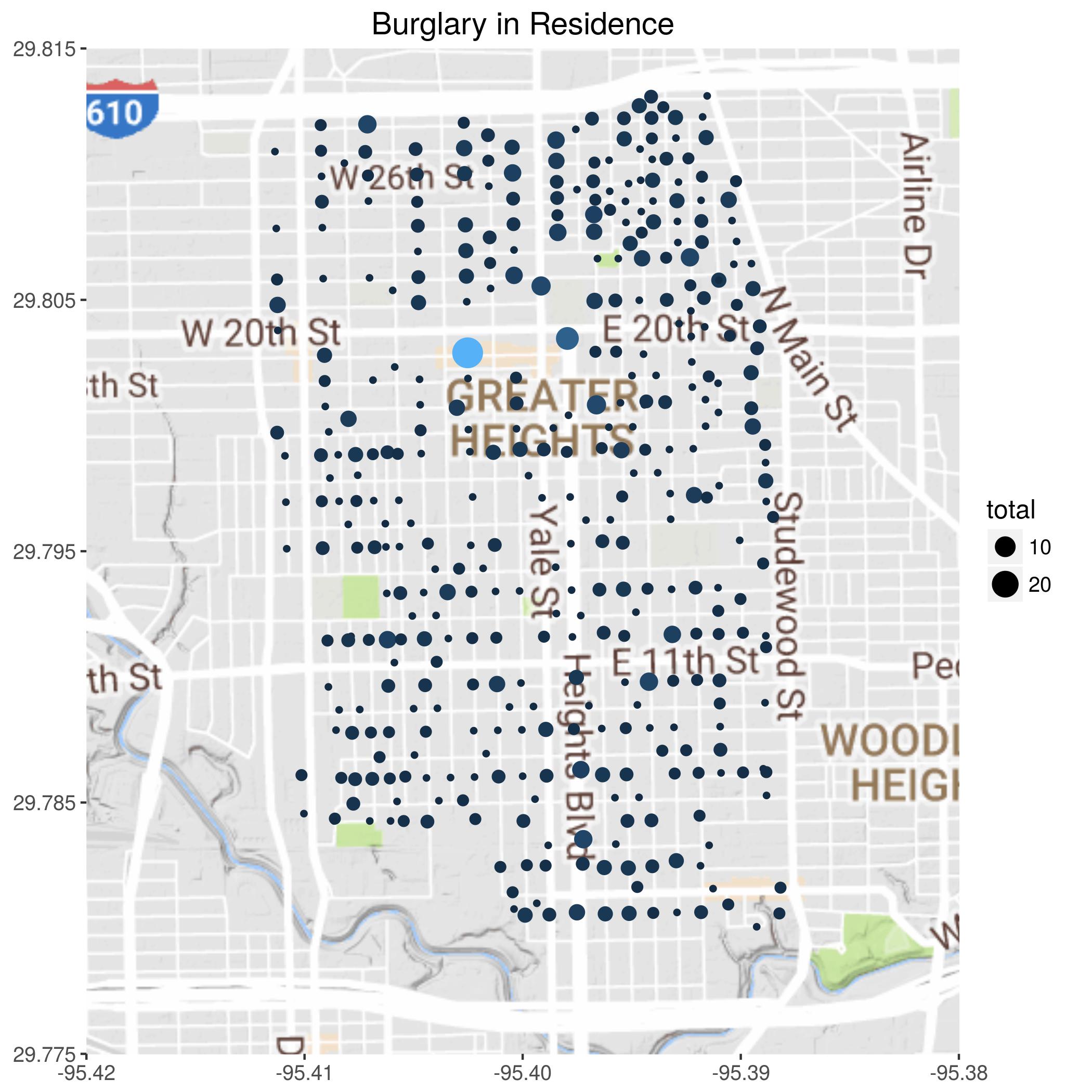
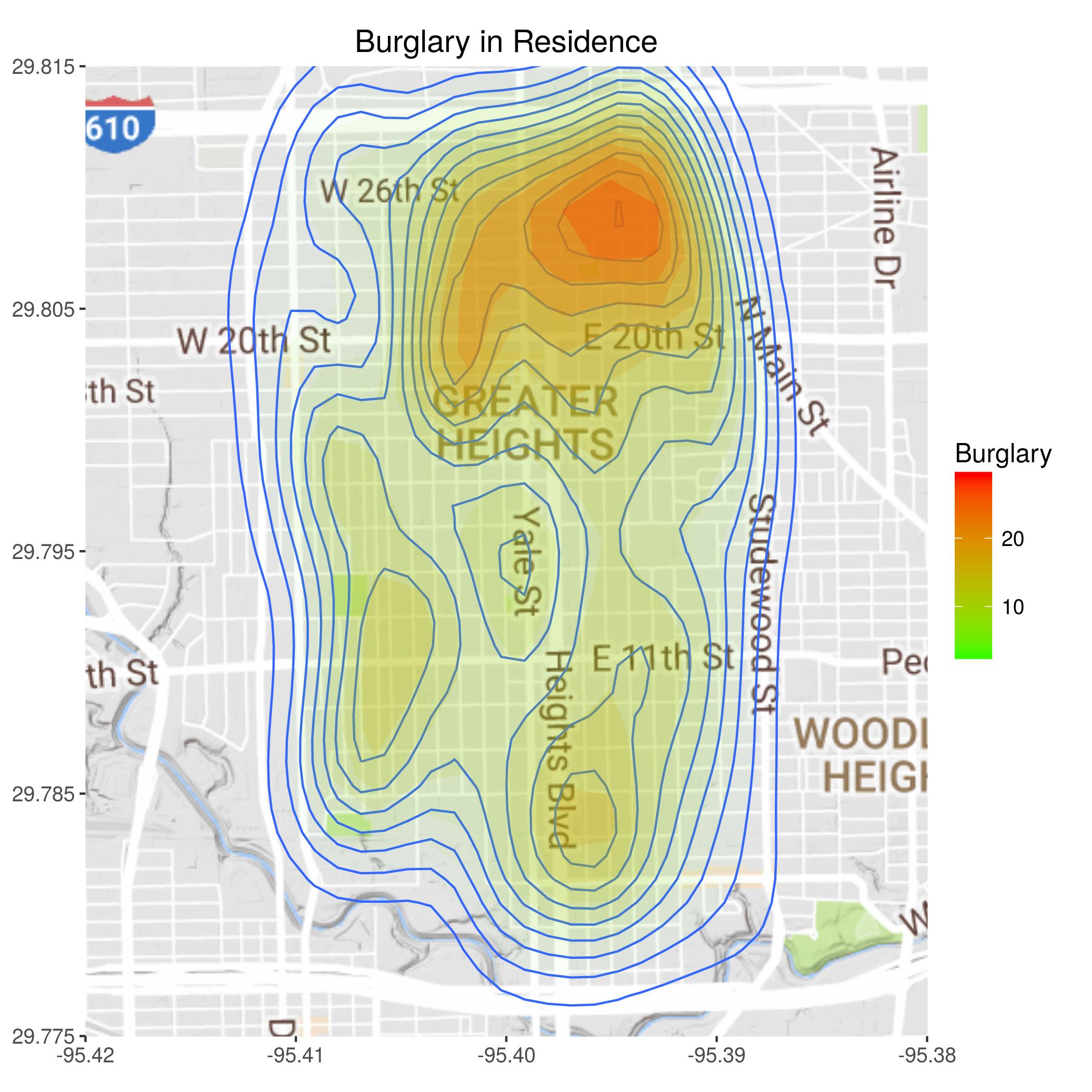
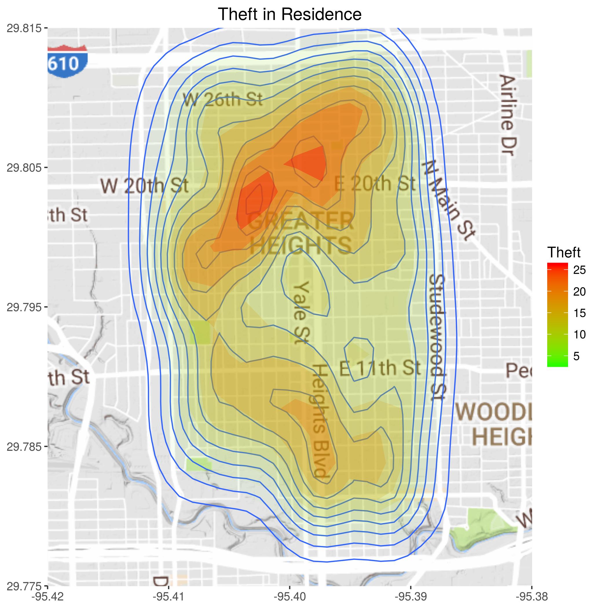
Residential burglary seems to be largely equal opportunity. The only interesting anomaly I see is the higher rate of burglary in the north-east corner of the Heights.
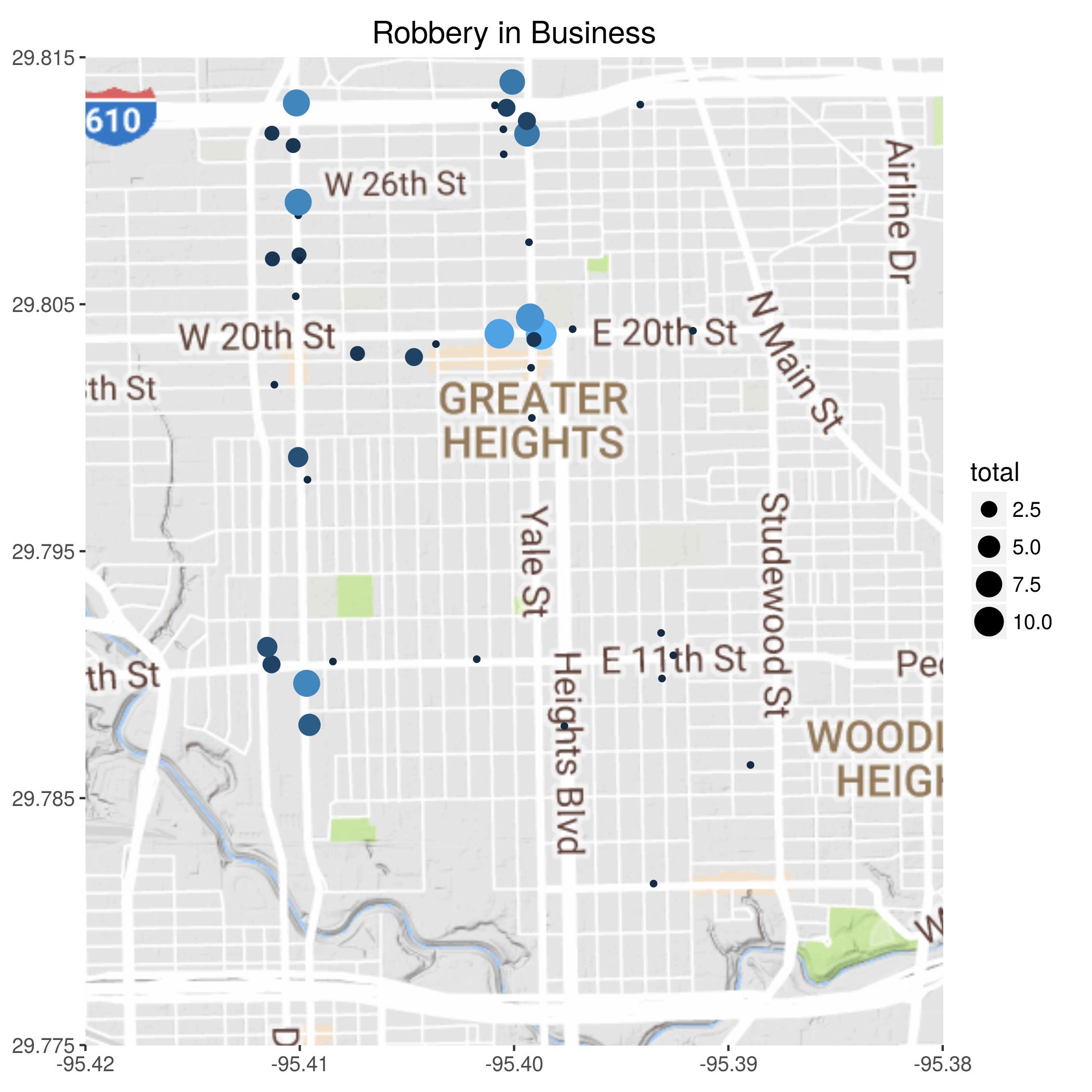
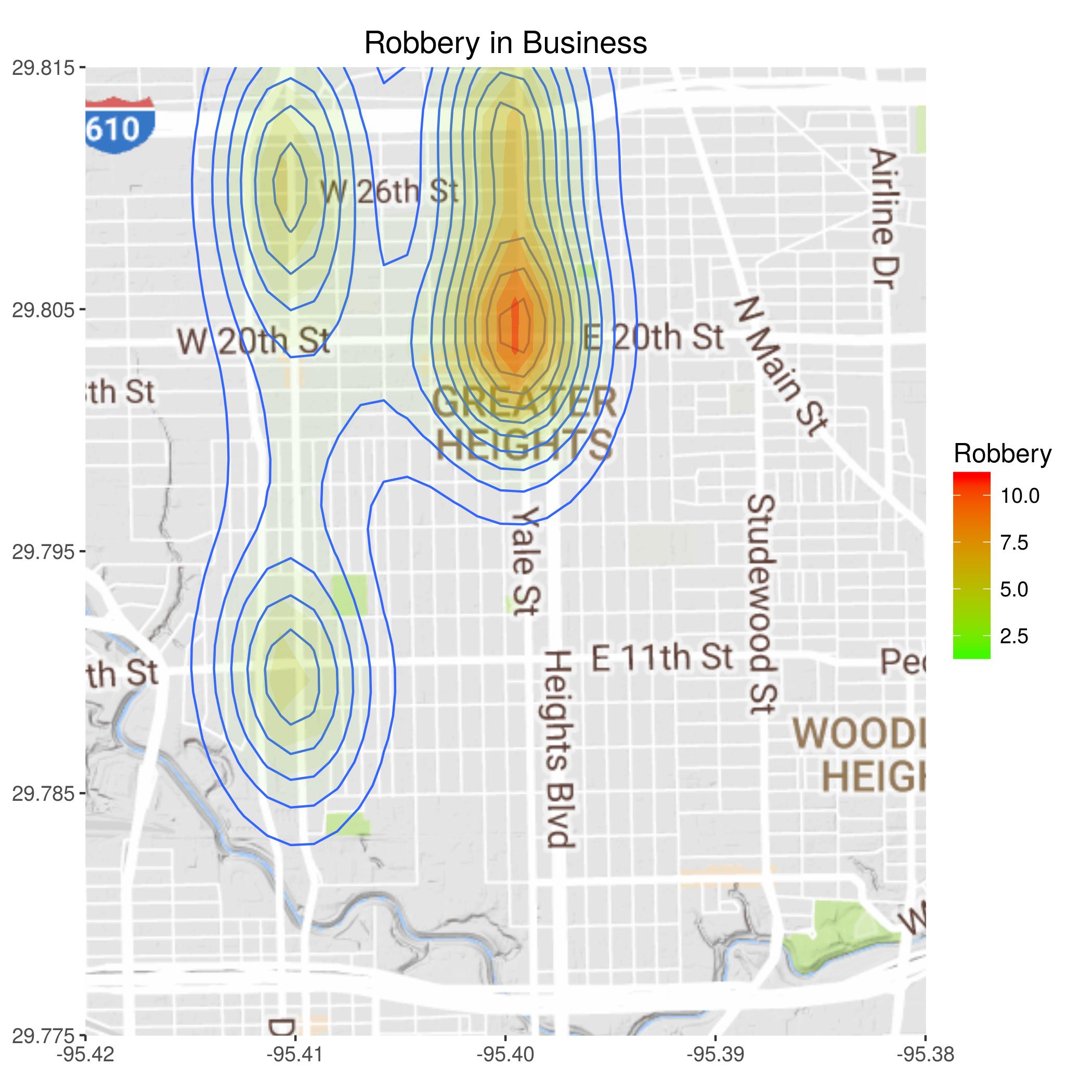
Now to scary crime - robbery. Clear hotspot at Yale and 20th - Kroger, CVS, and Walgreens?
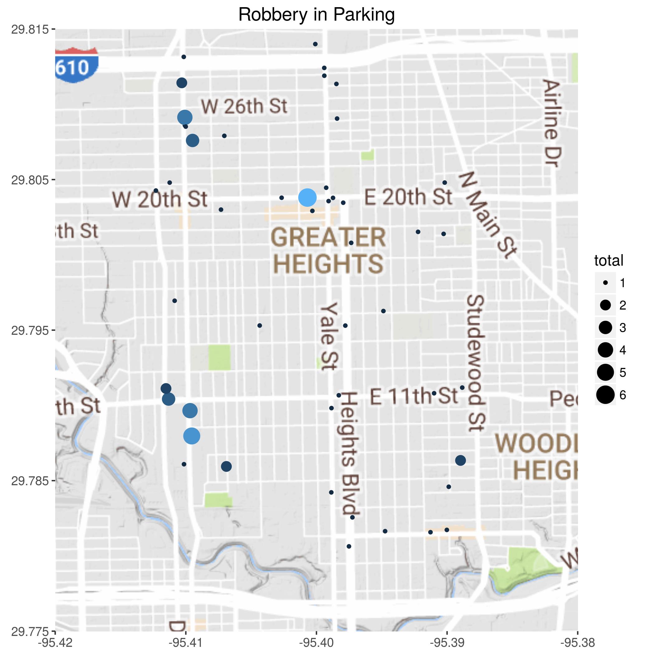
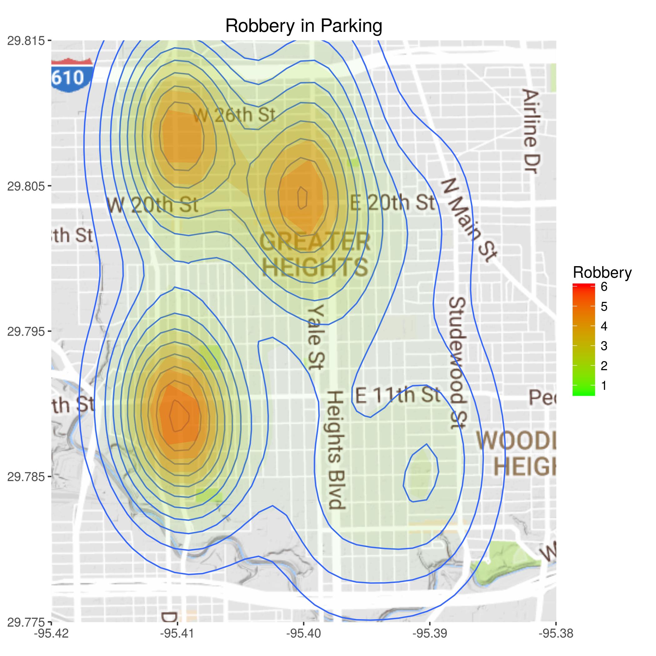
A few hotspots - Kroger?
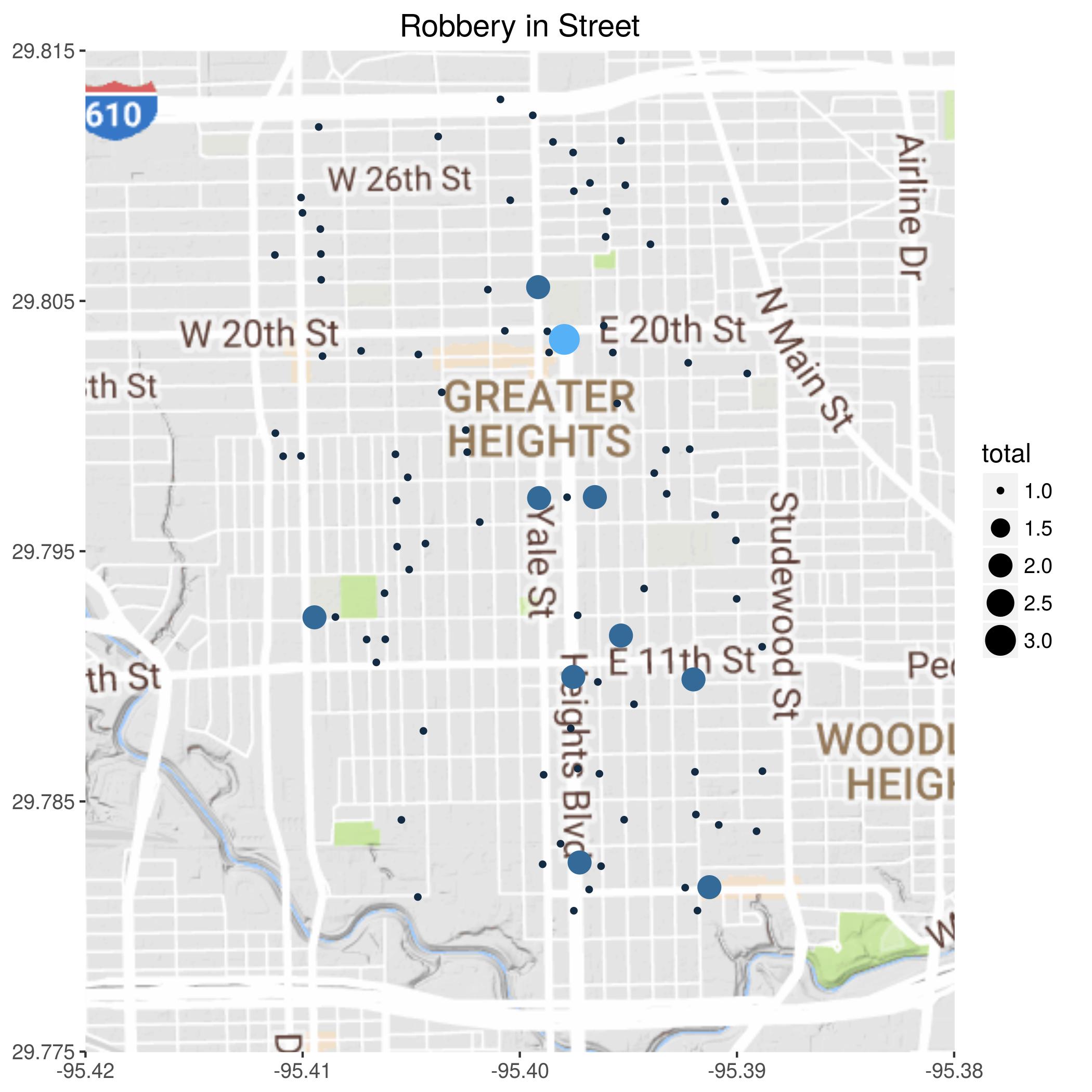
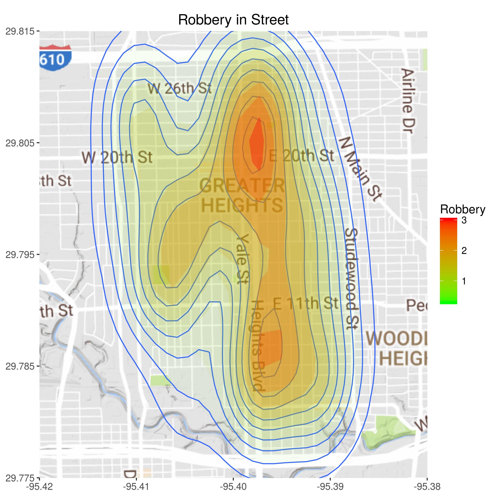
I interpret being robbed on the street as being mugged. In the interactive tool we will be able to look at the locations at different times of day.
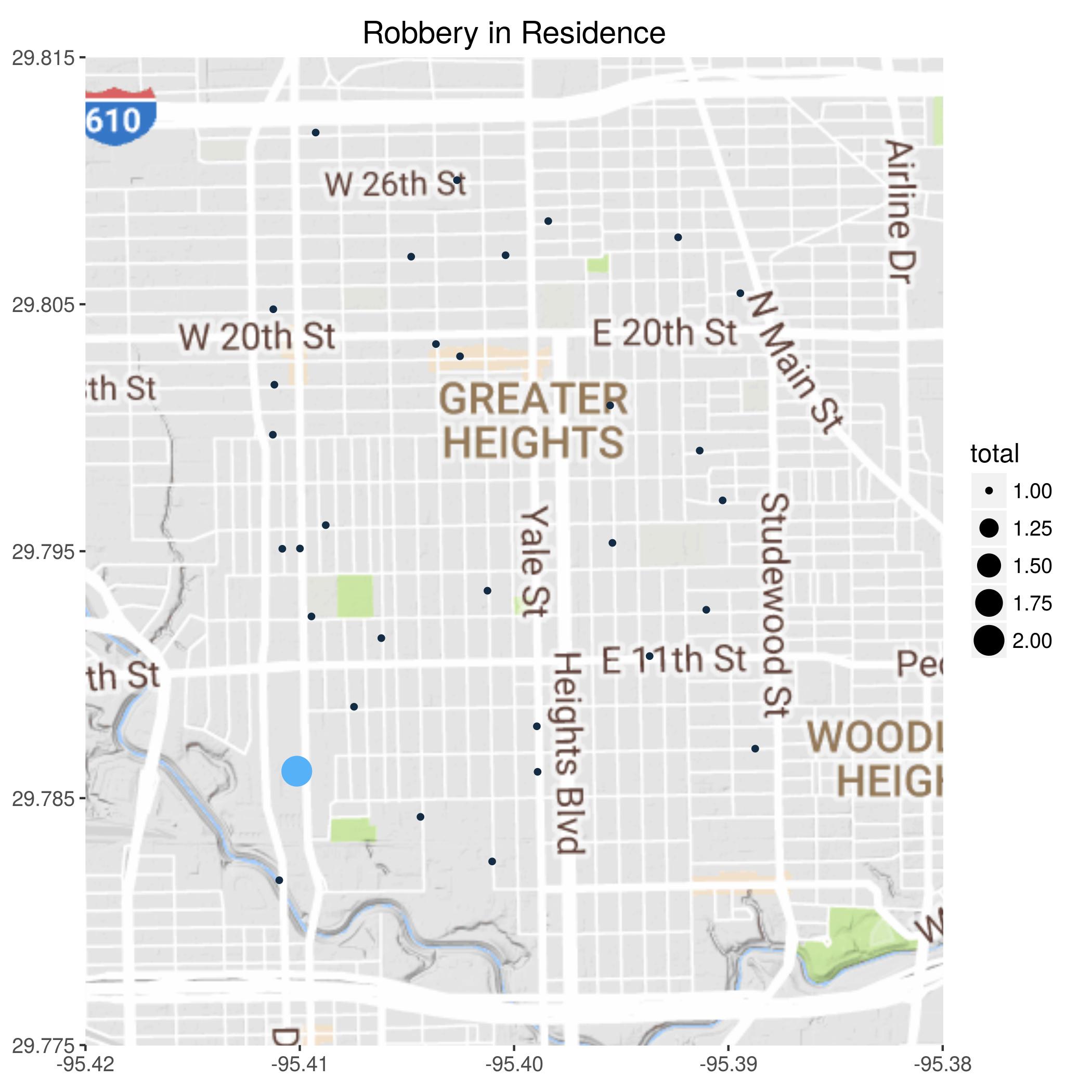
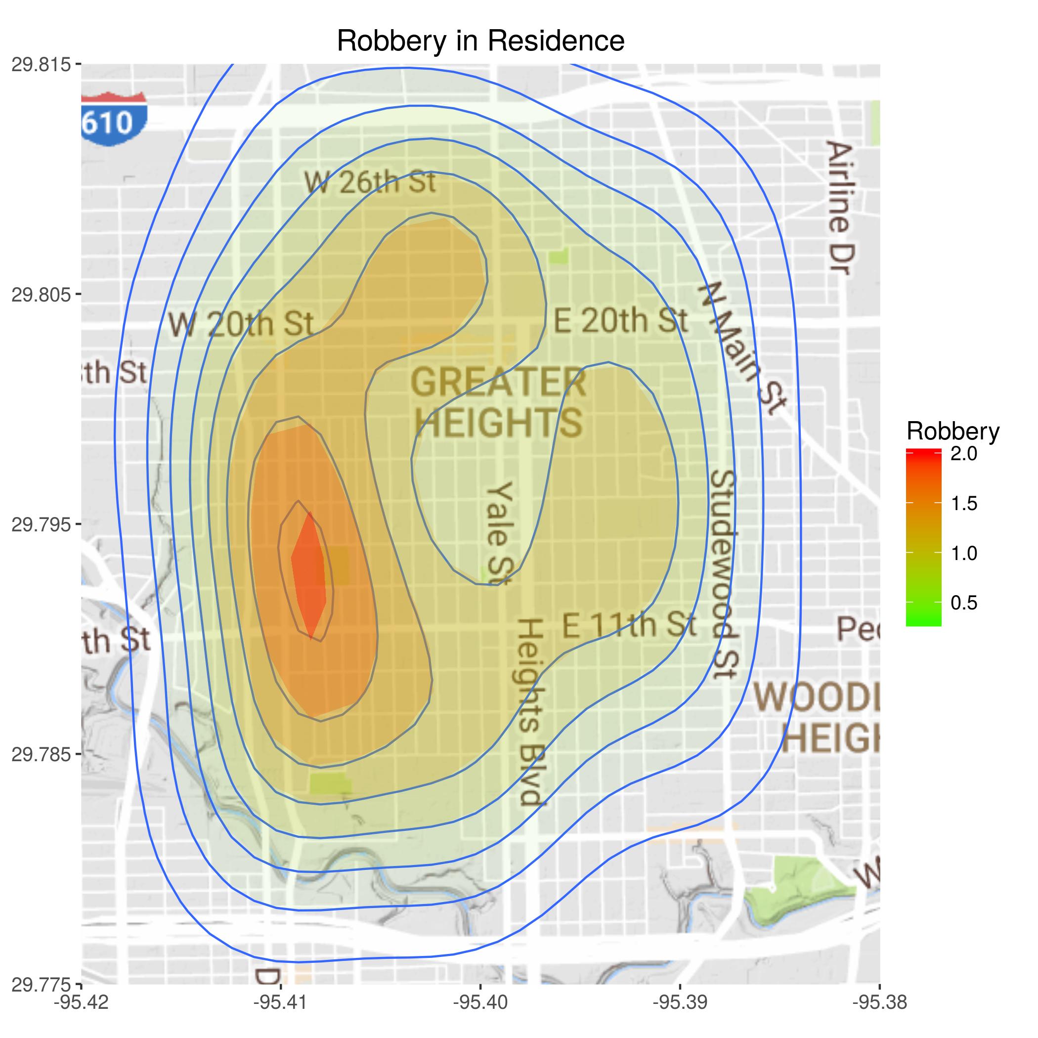
Thankfully the most frightening crime - being held up in your home - is pretty rare. If there is a bias it seems that the little strip between Durham and Shepherd is more at risk than other areas, but the difference is small.
Alan Jackson is a retired geophysicist, with time to learn some new skills and do stuff that may benefit the neighborhood.
Copyright © 2017 Adelie Resources, LLC